Adventure Time

Hey guys! Long time no talk, how has your summer been? We’ve been trying our hardest to actually start getting out this summer. The joys of not working! So we decided to take another little trip yesterday before I flew off to Vancouver for school.

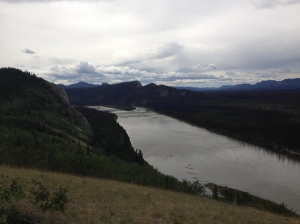
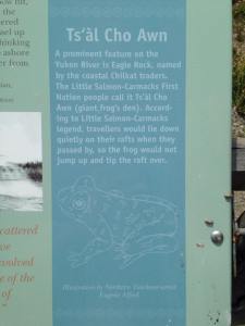
We hopped in the car sans dogs this time and headed north. Munchies in hand and Tim Hortons in the cup holders we set off music blaring and conversation errupting. What were we hunting for? Well a few things, morel mushrooms for one, we have always had a lot of fires some summers and they grow best the year after and the next. So we headed up past Carmacks and stopped at Eagle Rock to check out the site of the Columbian Disaster and the story of the Giant Toad!

IMG_5877

Eagle Rock Taken by Lily

11282115_10155704815190173_1570477771_n

The Giant Toad Story Taken by Kimberley

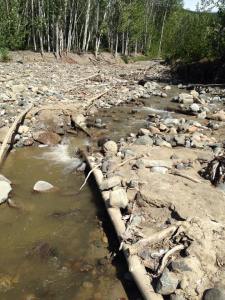
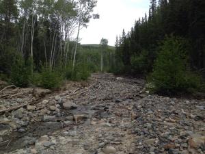
After scouring burned wood lots we headed back south and stopped at the old Agate mine just outside Carmacks. It’s quite the nice hike up the hill if you want to do it or along the creek bed. 1/3 of a mile from the little clearing you’ll find the gorgeous white agate deposits. 1/4 of a mile from the clearing on the creek bed you’ll find the geodes. Don’t be fooled they aren’t the nice fully hollow formed ones you get in the store, they’re just baby ones starting. If you follow the trail up the hill, you’ll hit points on the switchbacks where you’ll see the dark blue-green agate. It’s a gorgeous little walk especially on a sunny day and one of those hidden gems not even most local Yukoners know about.

11271938_10155704815020173_1125387450_n

11414597_10155704815120173_239484341_n

Happy Travelling!

xoxo

Lily
The Grass Beyond the Mountains

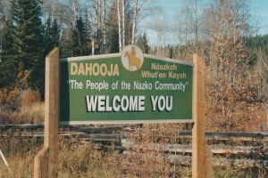
Welcome sign

Picture Taken By Lily

Alright guys, I think for the time being I want to dive in to a few of my little out of sight paradises and share it with you. This one is very close to home for me as I actually grew up living it almost every summer. Now if anyone is from the British Columbia area you may have recognized my title reference or you’re not from there at all but are just as much a Yannick Bisson fan as I am and binge watched Nothing to Good for a Cowboy when it was on, or the more common feature, you just ended up here and you figured you’d spare some time to read my post. Either way it let you hear… Now the area I’m thinking about is nestled away in the Cariboo region of B.C. is the small Village of Nazko. It lies 100km (60miles) west of Quesnel and is nestled in the heart of a rich logging, ranching and traditional Carrier First Nations culture.

Nazko is also home to the Nuxalk Carrier Grease Trail, which was a major trading route for the surrounding tribes spanning a 347km (158 mile) distance. It was also a big part of the trip for Alexander Mackenzie in 1793 who relied on Carrier guides along the Grease trail. Unfortunately in 1892 the reservation was formed and regulations were enforced. Although Europeans passed through Nazko was not settled until the Franklin family decided to make it their home in 1903. Followed by more prominent families, the Pennington’s, Udy’s, Johnston’s and the Harrington’s. By the 1920’s a man named Paul Krestenuk had established trading posts between Nazko, Kluskus and Ulkatcho for Carrier bands, homesteaders and ranchers alike. School’s were built in 1950 and another in 1960. To put this into perspective, logging moved in around 1976, they finally got electricity in 1984, the road didn’t get paved until 1985, and Internet and telephone services were not offered until 1999. CB radios were the only communication between people if you could afford it until Y2K! Ten-Four Rubber Ducky, over and out! (I spent my first 6 years of life every summer using one to talk to my grandparents).

Another major name in Nazko that people all know is Joe Spehar. He ran the largest cattle ranch in the 40’s and 50’s with a total number of 500 head. This is where my whole Richard Hobson Jr. reference comes in. Anahim Lake which is near where the Home Ranch is, is actually just a stones throw…as the crow flies away from Nazko through the Itcha Ilgachuz Provincial Park. Now, I’ve never personally been to the home ranch, but years ago during my grandfathers trek following in Alexander Mackenzie’s footsteps he had to pass by the home ranch where Panhandle Philips was actually still living and had the honor of eating a meal with him and hearing the stories of their days in the cattle ranching business. I highly recommend reading the books and even watching the TV show if you’re interested.

Moving on! Places to see in Nazko! There is a ton of hiking that can be done in this area…brace yourselves here comes the lists…

  1. Itcha Mountain Trail: I’ve never done it but, it’s got a spectacular view and it is all alpine mountain area. The park itself is young but the area isn’t ranging a cozy 110,000-hectare park, it is simply breath taking.
  2. Kluskoil Lake Provincial Park: This is a horse back riders dream. With tons of horse and hiking trails you’ll never get bored. It also leads onto the Alexander Mackenzie trail from TeePee Lake trail.
  3. Nuxalk Carrier Grease/Alexander Mackenzie trail: the trade route starts at the Fraser-Blackwater junction and ends in the Bella Coola Inlet a mear 347 Km (158 miles away)…this beautiful trail is worth the trip if you have a lot of time on your hands and horses for that matter! You can access this trail from two spots, from KM 64 from the Nazko Valley or travelling down the Batanuni Road 3 Km west of Gilles Crossing. There are signposts and some information for you to read before starting your adventure.
  4. Fishpot Forest Service Lookout Tower: Just another gorgeous view you can get here by taking the old Baezaeko Road at 5.7km following the third left to the top of the hill and enjoy. Note: they highly recommend 4×4 vehicles!
  5. Indian Head Rock: Located 21.5km on the Honolulu road on the west side of the Nazko River this large rock formation is better viewed from a canoe.
  6. Pack Rat Falls: Once I remember how to get there I will let you know….trust me its worth the scavenger hunt!!! Just a small hike up to a gorgeous falls, with small warm pools and pack rat nests lining the cliff face.
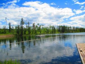
Marmotlake

Marmot Lake Swimming Area – Photo Taken by Jessica Sharp

Here comes the next list! I warned you…

Historical sights you really want to check out!

  1. Blackwater Homestead: This you can view from the Nazko Valley road on the right hand side after crossing the Blackwater Bridge. This was owned by Joe Spehar in 1912. At the peak of his ranching career the covered 1501 acres of private land and held 500 head of cattle. Most of the buildings you’ll see are original.
  2. Krestenuk Trading Post: The trading post was set up in 1920’s and ran until 1964 and was used for trading furs, supplies and also served as the post office. It is located past the Chuntezni’i Cemetery furthest building from the road.
  3. Catholic Church: The church was built in 1892 on the reserve and served until 1988.
  4. Chuntezni’I Cemetery: it’s a cemetery and for you creepy people out there (like myself) just being around it holds a lot of history in the air.
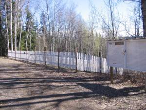
  5. Homesteader's Cemetery - Photo Taken by Teresa Sharp

    Homesteader’s Cemetery – Photo Taken by Teresa Sharp

    Homesteaders Cemetery: This small and gorgeous cemetery has a wonderful view and has been used since 1917. With its white fencing surrounding and multiple unmarked graves. The view of the Nazko River from the top of the hill is very relaxing. In the early 2000’s a committee was started by the village in order to clean up the cemetery and create a logbook of everyone buried in it, dates and where they are “roughly” located. This cemetery is just up the hill from my family cabin and I spent a few summers helping clean it up.

  6. Lashway’s: Continuing down the Nazko Valley Road you’ll pass through a small area that is where the Lashway family lived. I have personal family connections to them, as they were good friends and neighbours’ of my grandparents and my mom and aunt growing up.

I’ve enjoyed going there my entire life and the people are friendly and helpful if you need directions, Even if you’re just passing through take some time to admire the beauty of the area. Please remember to respect nature and the First Nations people when you are visiting though! Those are the rules! If I even tried to start a story I would keep you here all day…I’ve had so many amazing memories created there with the people that live there. I have life long friends I will always remember and cherish. Long story short, I’m just going to say enjoy the view of the area!

10552391_10152159141061682_5976849696293550959_n

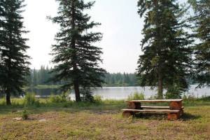
My Personal Family Cabin, My Piece of Heaven ~ Photo Taken by Lily

My Personal Family Cabin, My Piece of Heaven ~ Photo Taken by Lily

Have Fun! Xo ~Lily

Fraser, BC

I know it’s been forever since we’ve posted, and we had barely started to even get set up then, but we are back now and ready for a full summer of adventures! To kick off being active on the blog again, here’s a photo that I took earlier this afternoon on a day trip around a portion of the southern Yukon and northern British Columbia. This was taken near Fraser, BC, where the sun was shining super bright, a waterfall flowed down the rocks behind me, and the wind was nice and cool. – Kimberley

Springtime Fraser, BC in mid afternoon


The Perfect Shot

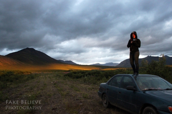
So when you are looking for the perfect shot while taking landscape photography, sometimes small bushes and whatnot get in your way of the shot you want. Lily’s solution in Tombstone Park last summer was this. The sunset was epic, and at some point we will definitely be adding a couple of the shots we got of it, but I figured I’d share some fun with you first. (That mountain in the background is Goldensides, which we climbed the following afternoon after a freezing cold sleep in our tent.)  – Kimberley

Lily resorting to drastic measures to get the shot ;)

Lily resorting to drastic measures to get the shot 😉

Confluence

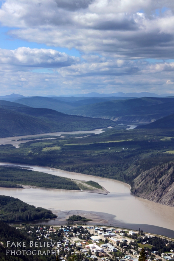
So to kick things off, I figured I’d share a photo I took last summer from the Midnight Dome in Dawson City, YT. Looking down the valley at the confluence of the Yukon River (the muddy one) and the Klondike River. This was taken last July when we spent a week in Dawson visiting and doing mine and dredge tours and whatnot. (Fake Believe Photography can be found on Facebook and on a separate blog here.) – Kimberley

Yukon River at Dawson, as seen from the Midnight Dome

Yukon River at Dawson, as seen from the Midnight Dome

Introductions (About Us)

Who we are:

Kimberley is from the far east of Canada, a tiny town called Heart’s Delight in Newfoundland. She was dragged across the country at the age of 6 to live in the Yukon, and has remained there since, taking any chance she can get to spend time outside in nature.

Lily is a born and bred Yukoner, who grew up hunting, fishing, and exploring the wilderness from a very young age. She also grew up learning skills from the local First Nations.

Kimberley and Lily waiting to cross the MacKenzie River by ferry

Kimberley and Lily waiting to cross the MacKenzie River by ferry

What we’re about:

Both girls love travelling, even if it’s just hopping in the car and going for day trips. Exploring new places and experiencing new things is something they both enjoy, and it’s even better when they get a chance to share that with other people, be it family or friends or other strangers along the way.

Experience:

Although neither has travelled extensively, both would love to do so. Kimberley grew up spending her summers on the road with her family, driving across the country from the Yukon to Newfoundland and back again, and has done that particular trip 13 times. At the time of writing this, the only province/territory in Canada she hasn’t been to is Nunavut. She’s driven through the northern United States with her family as well, and spent a few days in Mexico.

Lily spent most of her travel time in British Columbia and the Yukon, but has also made a trip to the maritimes to spend time exploring the old architecture and beaches there. She has also spent some time in central Mexico visiting the silver mines and old cathedrals in and near Mexico City.

What you can expect to see on this blog:

While neither of us travels a lot during any given year aside from small road trips, there are some big trips to share that have happened recently, and there are even bigger trips to come in the future. For every trip, even if it’s just a small day trip, if there’s anything worth writing about, we will share it in a post along with pictures. (Both of us are photographers, so pictures will definitely be posted with pretty much everything.)

We will be updating as often as possible, but as most of our day trips take us to places without any cell service or wifi, we probably won’t be updating during any of those days, or any trips that require us being in the wilderness for days on end.

For random tidbits and photos on the go, you can find us on Facebook here.